![]()
Letchworth Park Map, 1963
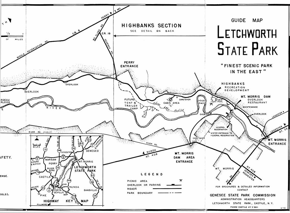
Park maps are the primary hand-out for visitors to the park today because of the complexity of the features and facilities and the need to outline basic rules and regulations. We have inserted them into our website because they also serve as a kind of chart of park development. The map found below was issued in 1963 and shows some interesting changes. We assume that visitors to our website have a map to make comparisons or are familiar enough with the park to visualize the changes that have taken place over the years, hence our viewers can visit the following links to see an illustration of this kind of study of the park. To see a listing of our other historical maps, click here. It should be noted that the drawing of this 1963 map was before computers and the precise square and aligned lettering was done by a very patient and skillful man named Francis Foote using India Ink and a "Leroy Lettering Set". This particular Park map had two highlighted areas, discussed below. Then on the opposite side was the complete Park map which you will find near the bottom of the page. |
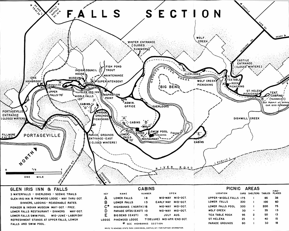 |
The subject of this section will be the area designated as “Falls Section” on the 1963 map (above). One of the first things that catches the eye is the “Winter Entrance” that is noted to be closed summers. This we know is now the Castile Entrance and is open all year. The other entrance change is that via the DeGolyer road ( a county highway) which is called the Castile Entrance. That access to the park is now gated so it is useable only at the convenience of the park. The next thing to note is that Trailside development and entrance road have not yet been constructed. The cabin areas in Lower Falls area still show Cabin Area "A" northwest of Cabin Area "B" and there is no road past the Lower Falls pool area. The St. Helena area, besides picnicking, has a designation of Tent Camping, (temporary) underneath and notes that you get "permits at office" and the "capacity is 200 persons". Interesting they used persons and not cars or tent sites as a capacity measure. Also note that land on the east side of River Road has been added so that a larger part of the road is now part of the park trail system, known as Trail #8, River Road. |
|
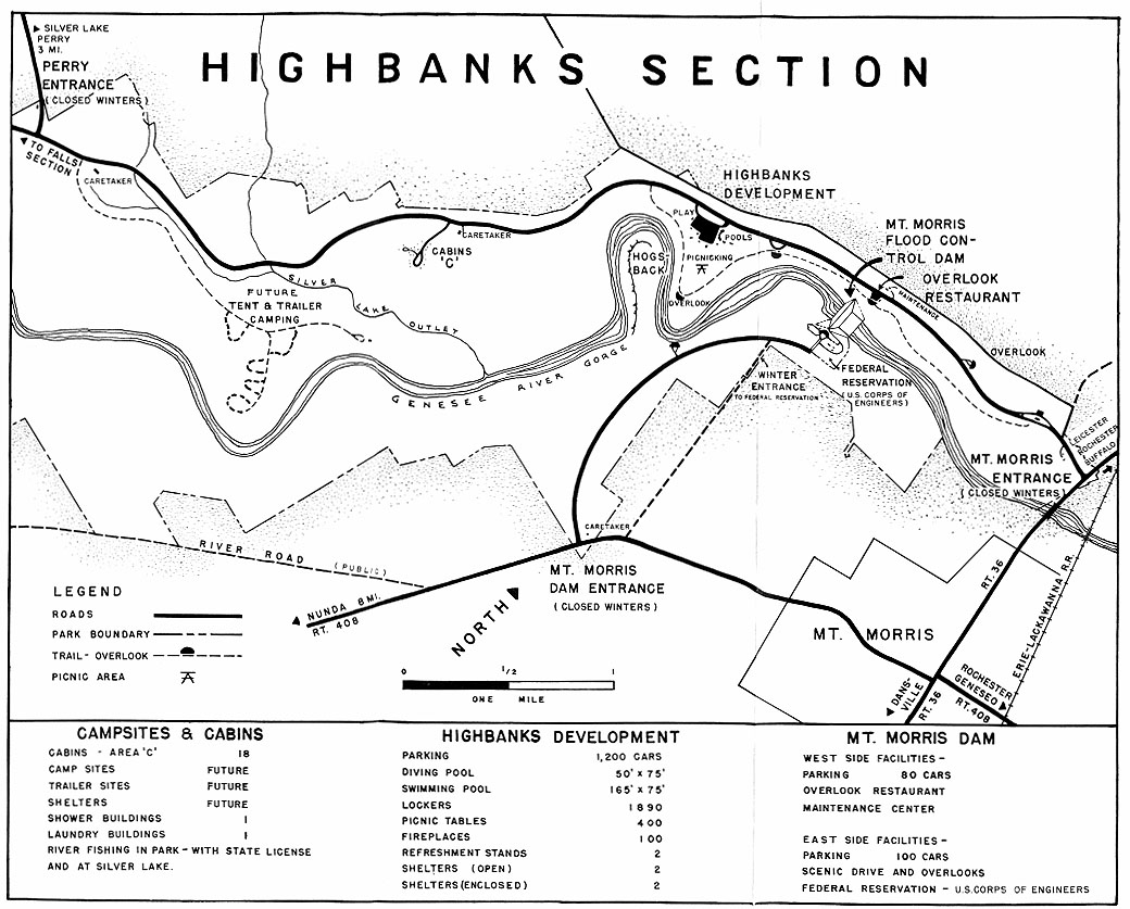
The next section (above) is designated as "Highbanks Section" on the 1963 map. If you begin at Perry Entrance you note a dashed line indicating a road and a note "Future Tent & Trailer Camping". As far as we know the road, the loop and building at the end of the road are known as the Kisil Point shelter and are a CCC product. The loops shown are an illustration and actual construction does not look the same or have the same number of loops. A much smaller shelter also exists now that is closer to the steep bluff where Silver Lake Outlet joins the river far below. The building shown is (was?) a typical log picnic shelter with stone slab floor like those in the south end of the park. It was accessible by a trail through what used to be "A" loop but now we believe is the "100" loop. Also in the vicinity of the Perry Entrance there is a Caretaker house shown and that is a residence acquired with the land as the park expanded and is still in use for that purpose known as the Littledyke house. At the "C" Cabin area is a Caretaker building and that is one built by CCC at the time of the cabin construction. Property lines remain pretty much the same now as those shown. These are largely the result of specifications by the Corps of Engineers to accommodate their plan for the Mt Morris Reservoir. The complete 1963 Map is found below: |
 |
|
Tom Breslin