|
There was a time when the Pennsylvania Railroad sent excursion trains to what was then known as Portage Falls. Now the tracks are gone, and the route is marked by the Greenway Trail (Trail #7 in the main Park). There were several small structures between the Oakland and Portageville that were once familiar to travelers, but they, like the railroad they served, have vanished. With the help of several contributors, we have put together a short photo essay that shows several of these structures and other features that were on what is now State lands. We thank Jim Gelser, Karen Gibson Strang, and Ted Bartlett for sharing these images with us. We have identified within the photographs which images and information they each shared.
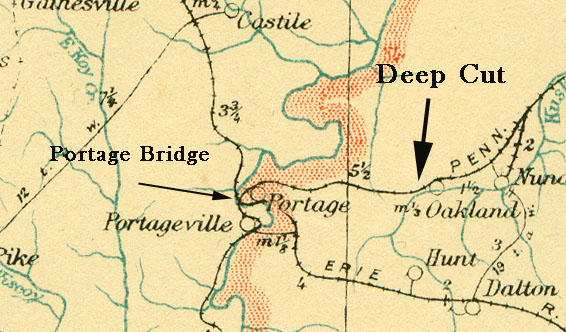
The map below is taken from the 1912 "Postal Routes of New York State". It shows the Pennsy line from north of Nunda to south of Portageville. The light blue line and red stipling marks the route of the Genesee River. The modern Park runs approximately from the Portage Railroad Bridge north (top) along the river. The right of way of the "Pennsy" was transferred to the State of New York and is now part of the Greenway Trail System. |
 |
|
|
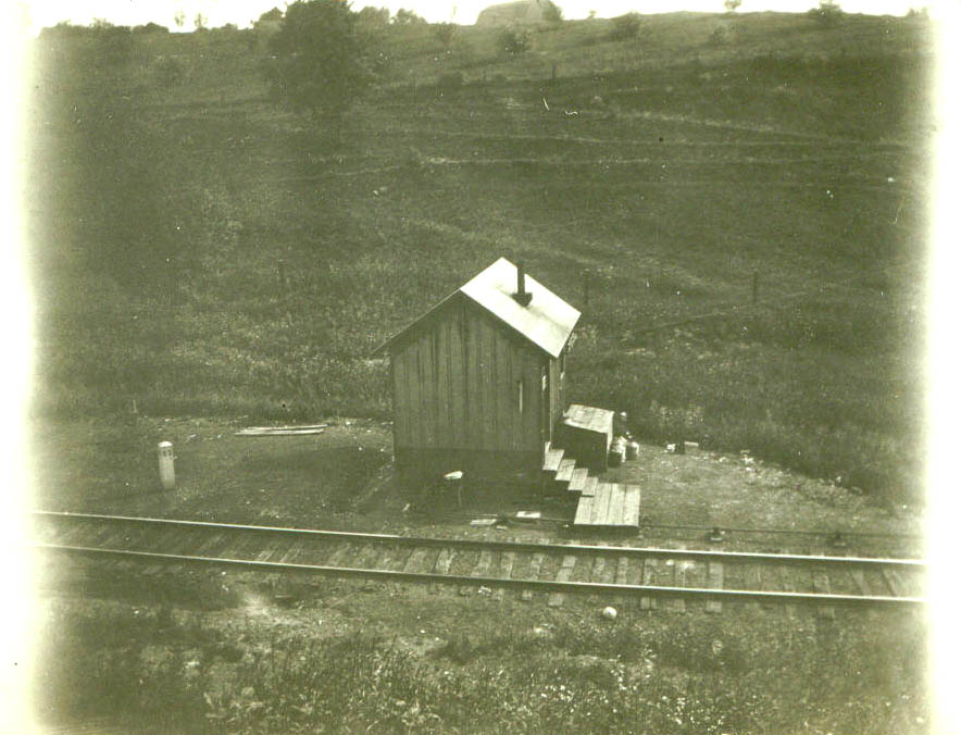
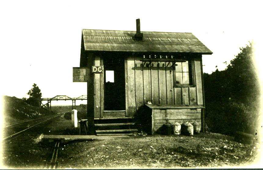
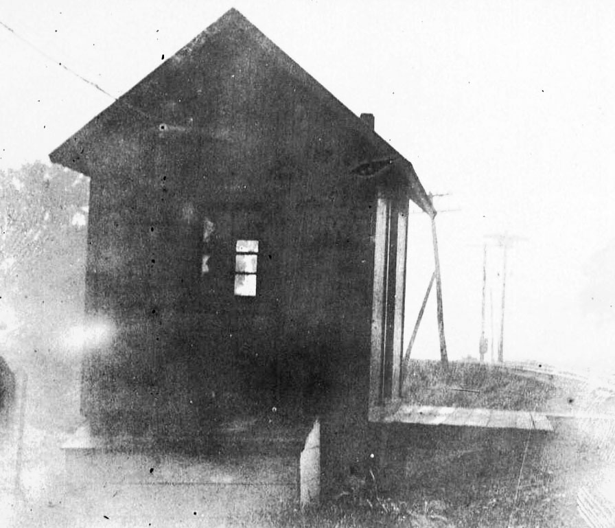
The first structure west of Nunda was a small building in Oakland. A photograph of that building and of the Pennsy depot in Nunda can be found on Nunda Historical Society website. Then came the Deep Cut, dug by Irish workmen for the Genesee Valley Canal. When the railroad ran through, a small telegraph building was constructed. The operator had the responsibility for the signal lights that were just down the track. The following photographs were taken by the Gelser Family sometime in the first few decades of the 20th century. All these images were sent to us by Jim Gelser, son of William H. Gelser. The parts of the descriptions to the left that are in italics were submitted by the person who shared the image. Also see Image 177. |
| "The telegraph shack at Deep Cut (Mile Post 53) was near where William Road crosses the Greenway, west of the bridge. Not too long ago there was a piece of pipe painted white in the ground close to where it was located. Someone must have removed it for some reason. The remains of that building were still there in the late 1940s"- Jim Gelser |
 |
|
The bridge in the distance once carried Short Tract road across the Deep Cut. This bridge was west of the present bridge and was replaced with an earth fill section over a culvert to provide continuation of the drainage. The "DC" stands for Deep Cut. |
 |
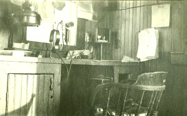
| Inside the telegraph building at Deep Cut. William H Gelser worked at this desk from about 1919 to 1923. |
 |
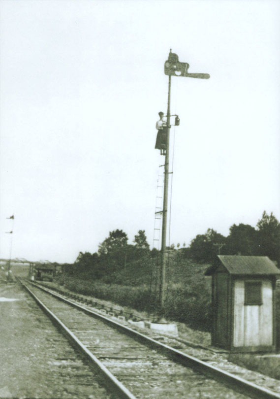
| "Martha Vail on the Semaphore Signal Tower. You can see the controls from the telegraph shack up the tracks to the signal tower. I expect that there were levers near or inside the telegraph shack in order to operate the signal.....The Block operator as they were called, would have to climb the tower to clean the lenses of the signal, trim wicks, and replenish with kerosene. Marth Vail worked a Deep Cut for several years...." Jim Gelser. |
 |
|
|
Beyond the Deep Cut was a small siding called "Lewis' Switch" by the local folks. It was named after the Lewis Brothers who came to Portage in 1879. The brothers established a lumber camp below the Lower Falls and began to harvest the timber there. First they floated the logs down the River, but after the railroad was built they moved their lumber up to a siding to be loaded onto cars. The images below were also sent to us by Jim Gelser. |
| According to a 1903 map of Portage, the siding which probably marked the location of Lewis' Switch was just north of the intersection of Williams Road and River Road. |
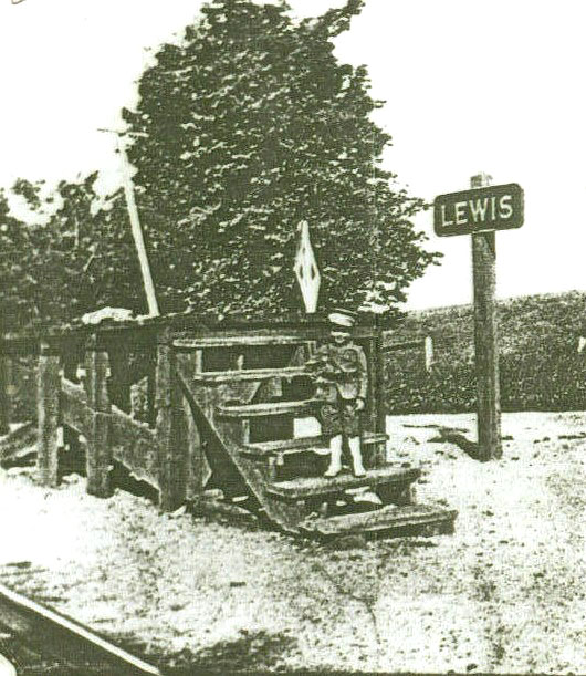 |
| "Lewis was ... just north of Deep Cut. From what I have been told, there was a siding there used there so trains could pass. Also pusher engines were used to assist trains up the grade from Nunda. Once at Lewis these pusher engines would return." - Jim Gelser |
 |
|
|
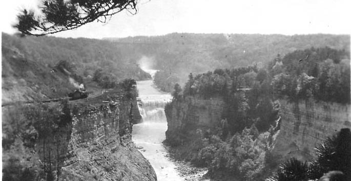
Still following the path of the abandoned Canal, the railroad ran along the edge of the cliff to the slide area. |
|
It was once possible to stand at Inspiration Point and watch trains pass along the top of the opposite cliff. In this photograph something is moving along the tracks - either a single engine or perhaps equipment similar to the steam shovel shown below. For a another view of the tracks in this area see image145 |
 |
|
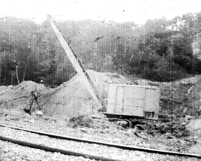
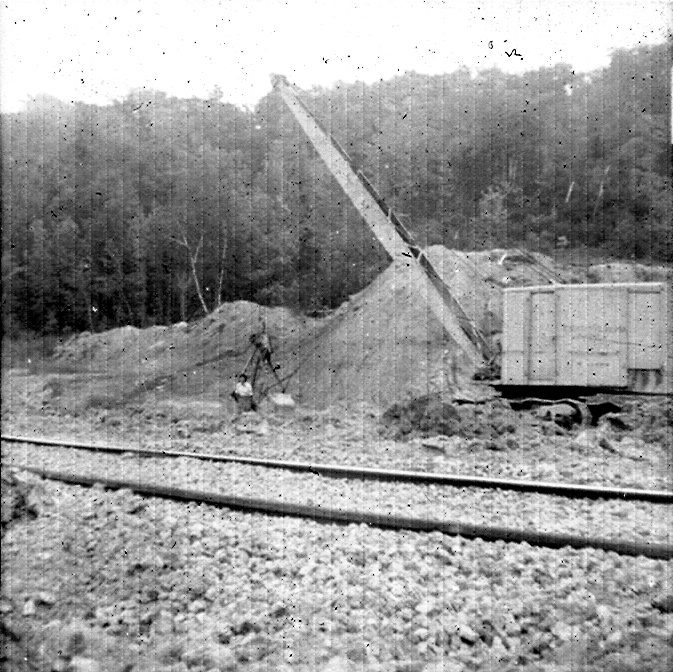
The Slide Area near the Middle Falls had posed a problem for the old Canal - the railroad had to keep a steam shovel nearby to keep the tracks open. Ted Bartlett sent these images and the following description: These photos were taken in 1960, with my black Kodak Hawkeye camera I was 11 years old then but had been hiking to the areas since I was a little kid.Our family used to walk the RR from the locks to P'ville as a regular hike, often. I was always fascinated with the slide area and the fact that the steam shovel had to constantly repair the areas that kept shifting. I was there many times when the shovel was working and moving earth and debris. There were always two guys operating it, and once or twice I got a ride on it. They were never too busy and really enjoyed showing me around. It was bright yellow and the letters on the side that said Pennsylvania, the N's were backwards. The shovel scooted all over the place including onto areas that I thought were awfully steep and close to the gorge edge. Once I was there and one of the shovel's tracks had broken and there was a repair crew working on it. My Dad and I were always looking for clues about the canal and possible surviving features of the old structures in the area. We did find foundations that we were sure were canal related, but later figured out it was probably from the small rr station that was there." - Ted Bartlett Ted believes that it is his
mother, Sally |
  |