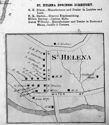
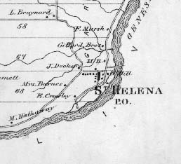
The following two images are taken from the "New Topographical Atlas of Genesee and Wyoming Counties, New York. Philadelphia: Stone & Stewart Publishers. 1866". For more information on this "Ghost Town" see glimpse of St. Helena.
|
|
The map to the left shows the community of St. Helena and the surrounding area. The St. Helena Bridge is visible in the river just above the "mill". Below is a detailed map of the village along with its "business directory". Both maps are part of the Town of Castile Map found on page 57 of the atlas. |